California Prop 12

Over the past couple of years i’ve grown more in tune with farming. Listening, watching, and reading a variety of sources. I have tried to be open to all the sectors of the AG and homestead commnity. Its been clear that the more acerage you work, you either need more labor or more chemicals. Consider my sweet corn this year. I planted close to 2 acres of corn, but one particular half acre plot was my focus for food. It was planted with a hybrid sweet corn. I applied 3 foliar treatments of 20-20-20 and one heavy side dressing of 10-10-10. No other chemicals were used. For weed control I used my dad’s old Massey Ferguson 204 and a one row cultvator. This weed control worked well until the storm. When the corn was about knee high we had a heavy thunderstorm with a downburst and it laod all the corn over. It recovered over a week or so with almost no damage, but that week was enough to allow sunlight to the ground and the weeds to take off. We still look to have a good crop, but not as good with the weed competition.

I could have spent hours in the garden with a hoe, but i don’t have that time. I could have selected a round-up ready variety and sprayed my way to success, but I don’t really care for that many chemicals. Those are the two option, more labor or more chemicals. This is corn for my family so there is no one to pass the cost onto through produce sales, and thats OK. We’ll eat corn we grew. That brings me to Prop 12.

California has passed a mandate that determines how pork sold in the state must be raised. The prop also has some restrictions on poultry and beef. The pork is the big kicker. Now farmers across the mid-west have to make a decision, do they change their entire operation to meet California’s demands or no longer market to California. Its a hard choice. Some farmers are growers for the big firms and if they tell them to change, they will have to and then pray they won’t lose the family farm with the cost. Smaller farms that are not tied to big ag corporations could maintain their current operaions, but they will need to compete against the economies of scale the big boys will bring to the table.

The cards are stacked againt the smaller guys. I’ve linked a Joel Salatin video below. He states this point far better than I could during his testimony to congress.

Long and short of it, California has passed a law they think is right and now their citizens will be facing a pork shortage and $10 a pound bacon. As Thomas Sowell says “There are no solutions, only trade offs.” In this case the trade offs are not good ones in my opinion, consumers and farmers will pay the price for an invented morality.

Joel Salatin at Congress

Singing School

Years ago when I was in middle school I went to singing schol for the first time. Its a southern tradition that uses shapes to desiginate each pitch on the scale. The first year I went it was a 2 week overnight camp and I was scared. I didn’t know anyone and I didn’t want to be away from home for that long. By the end of the first week I was so excited that I could not restrain my joy to return for the 2nd week. I had been exposed to some of the songs in old connvention singing books, but didn’t fully comprehend it all. I would sit next to people and be amazed at their ability to sight read with ease.

This week my children got to spend their second year attending singing school. Watching their joy everyday as they experience the North Georgia School of Gospel Music has been fablous. My beautiful wife has done the hard task of driving them to and from each day. I wish I could join them. Some of the gladness I feel comes from seeing the staff at work. A couple of my kids have Mrs. Janet. I can remember when I was in singing school that Janet was one of the students along with me. I look around and see so many others I went to singing school with now teaching my children. The incredibly talented Myers Trio (Justin, Jason, and Jessica) now teach classes. I was definetly transported back in time to watch them perform again.

I got to sing a little Bass this week. I was able to sit next to Nelson Bailey and sing a few new songs and even some old favorites written by Jack Clark and Glen Wilson. Nelson is an amazing musician and is kind and talented. While looking through some old videos on youtube I found me and some friend directing a Nelson Bailey song from 20 years ago. He was a good writer back then, some people just have the knack.

Glen Wilson was a mainstay teacher at singing school in my youth. No cooler man may have ever existed. His tall, thin figure and plesant deamanor made anyroom he inhabited a joy. The fact he drove a blue El Camino and was Texas native just made him all the greater of a legend. Glen had the ability to craft a song and not forget that the Bass section likes to do more than sing the root of every chord. But when singing a Glen Wilson song you had better be looking 2 to 3 measures ahead because he was going to sneak in a eighth rest you weren’t expecting.

The smoothest operator in any of these circles was by far Jack Clark. Never has a piano been touch with such velvet layered authority as when it is in Jack’s hands. Jack’s life has been in the music business and that dedication is clear when he appraches anything. A quick glance at a song or the group singing it and Jack has the instant ability to make it 10% better with a slight dynamic suggestion or the floursing of a few notes on the high end of the keyboard.

I’ve met many people in my time, but few have proven as fast and true as singing school friends. When Dacula won the state AA Quartet title in 1996, two singing school friends (Joel Singleton and Cliff Duren) were on the winning quartet in AAA. IN the 1990s I rode with my grandfather to a singing at Belmont. I was afraid I wouldn’t know anybody. The first thing I heard when I walked in the door was “Hey, theres Eli” as some folks from singing school were there.

Each night this week I’ve loved hearing what my kids have learned. They run in with their cousins showing me staff paper with sharps and flats. I watched as teachers referred to them as “The Stancel kids” and smiled broadly as they keep calling Jude “Eli.” To see my kids singing a Nelson Baliey song that I sang 20 years ago brings joy I just cannot explain. I got to watch my kids practice conducting this week and hear them practice intervals. Those skills are something that they will have the rest of their lives, just like the friends they make at singing school.

Eli-June 17, 2022.

A Nelson Bailey song I led in 1999 that my kids got to sing this week.


The Love of Money and the Rivian Deal

         I’ve been processing this for a bit and I cannot craft my feelings with eloquent precision so forgive my ramblings.  After reading through these posts for the past months I thought I might share a few thoughts. 

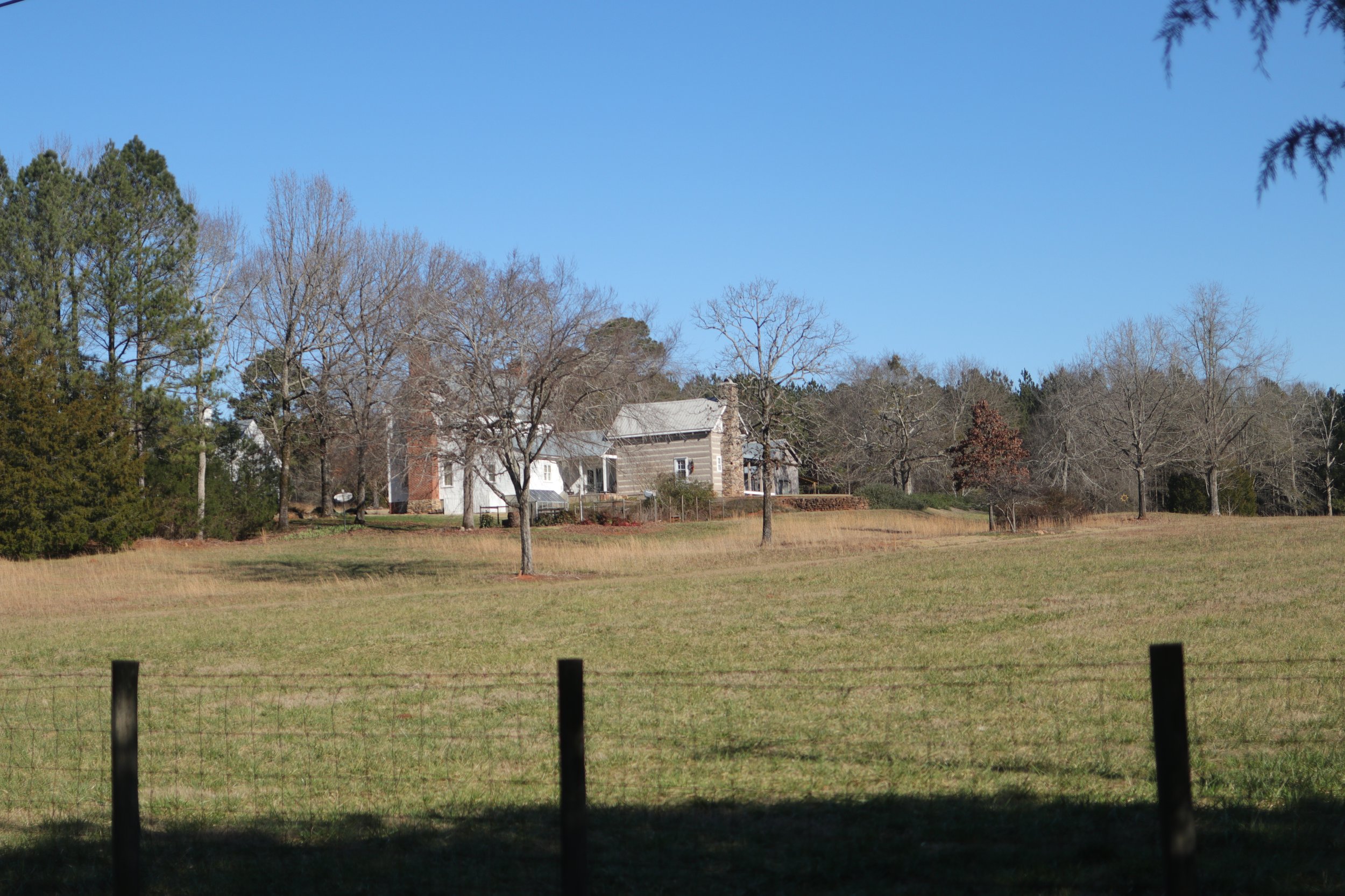
First, I would be called a transplant.  We moved to Morgan County last year.  We have spent a great deal of time researching several counties, cities, and reviewing their long-term growth plans.  I looked at infrastructure, population history, and development plans.  At the conclusion of our search we came to Morgan County.  With 20,000 people, an agricultural economy, and no major industrial infrastructure it was the clear choice.  We love our little farm and the community.  I love that on a recent trip to the dump I ended up having a 30-minute conversation with a lifetime resident because she did not recognize my truck.  We talked pleasantly about the community’s past and our shared passion for genealogy.  This is why I brought my family here, not to change things, but to be a part of things.

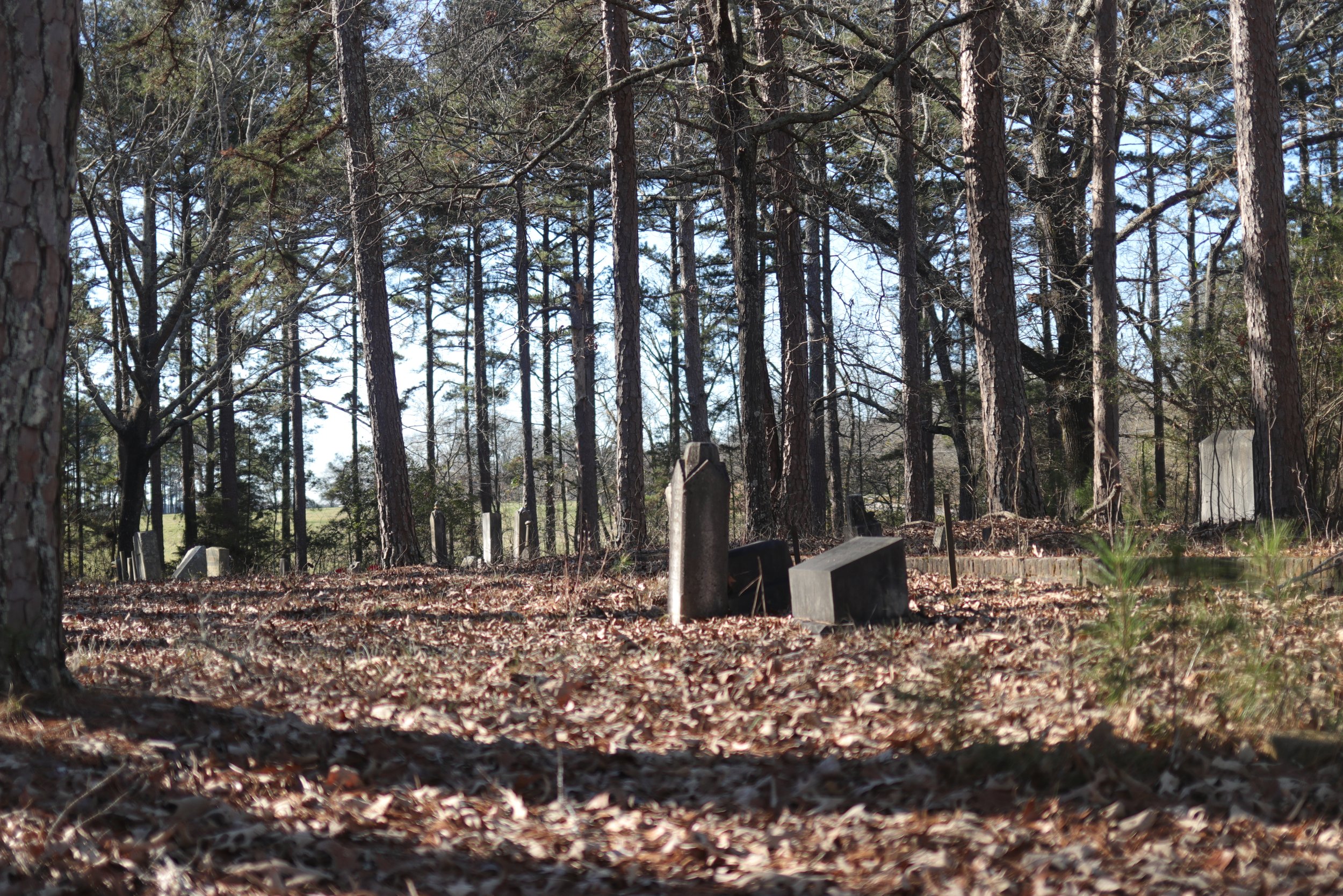
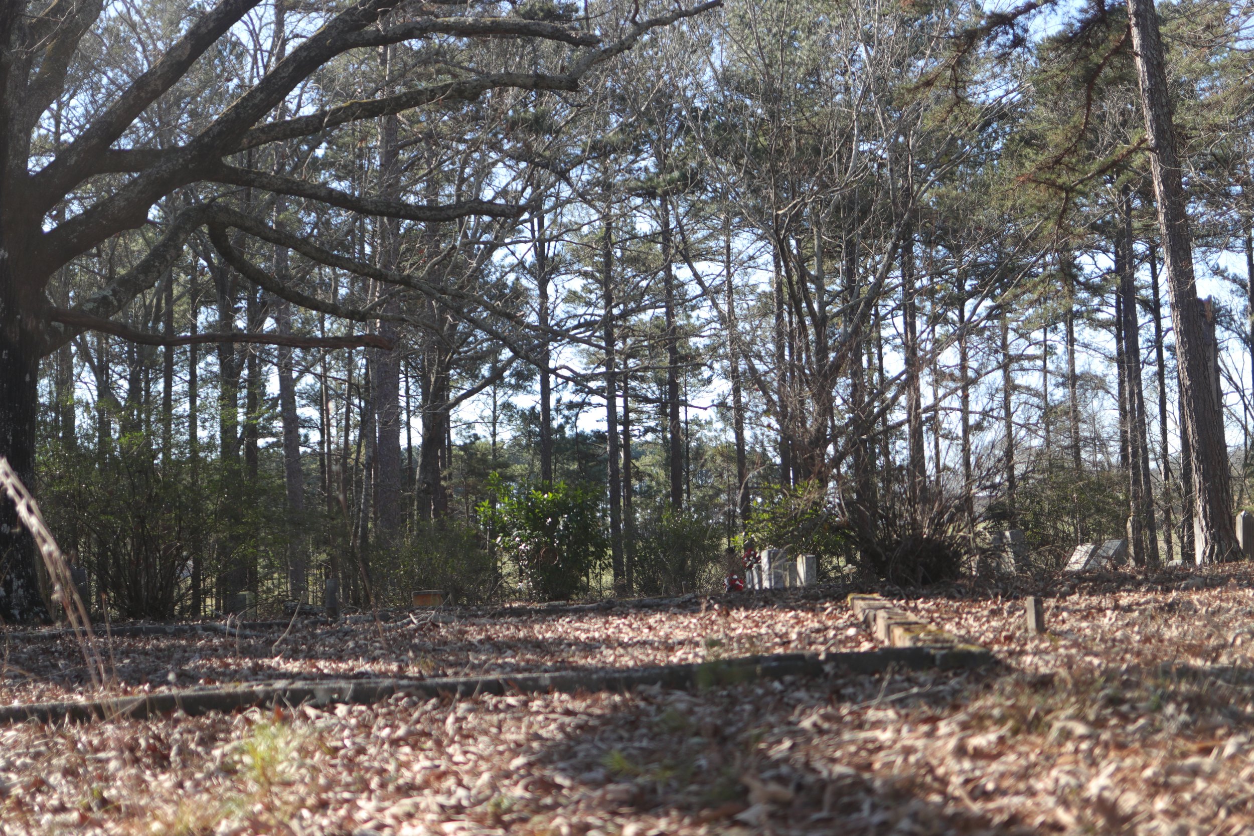
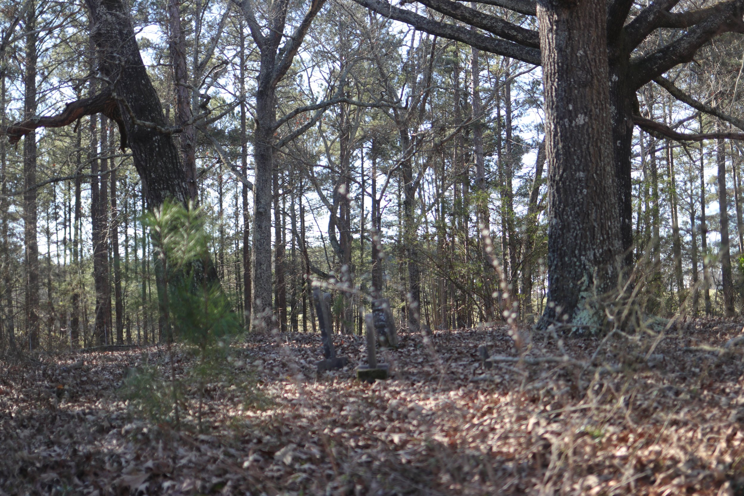
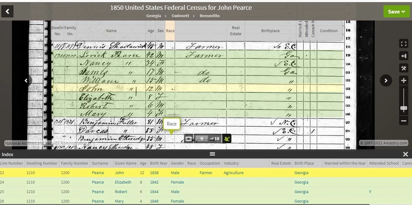
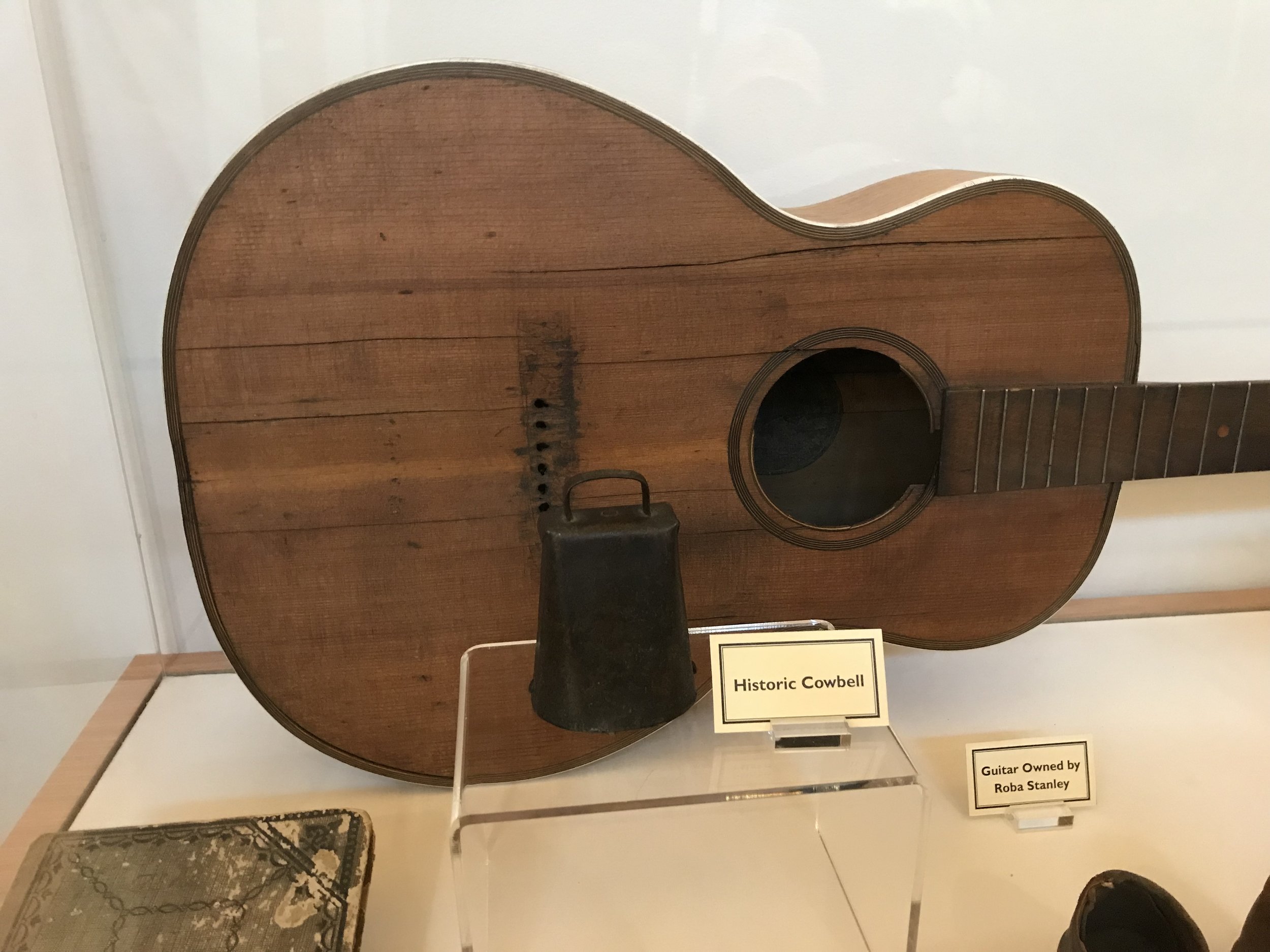
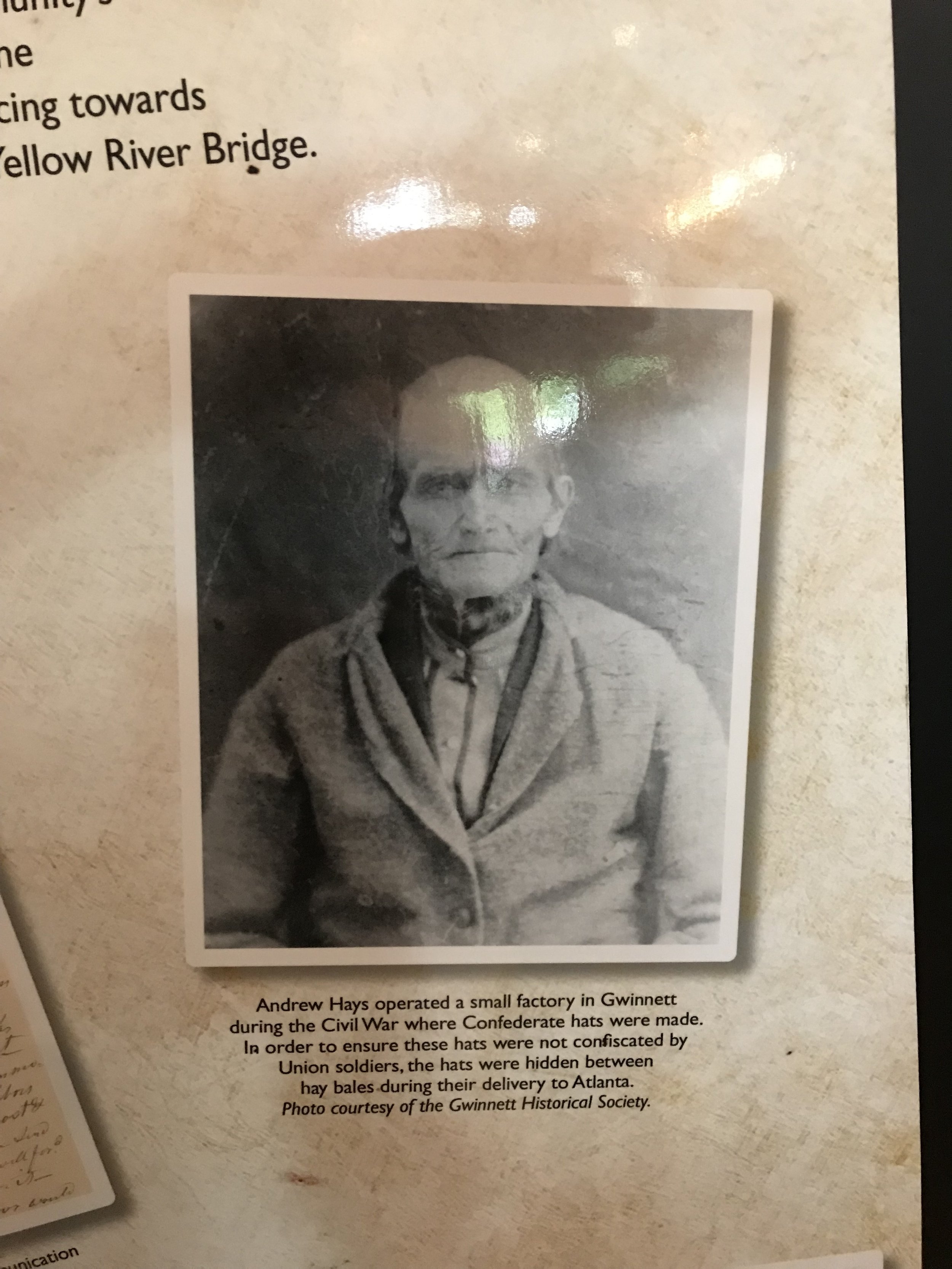
I transplanted from Gwinnett County.  My family has been on the banks of the Apalachee River there since the 1790s.  Yes, the 1790s.  I have a deep tie and connection to that place.  I have many memories of the stories the old timers shared with me about where things happened and who lived at specific places and what events shaped the places.  As a kid I could take my 22 and walk for hours through fields and hardwoods without seeing another person.  I grew up off the Hamilton Mill road exit of I-85.  As a child there was one gas station there and it closed for lack of business.  It was a beautiful place where neighbors knew each other and maintained their community.  I want my family to experience that same closeness, so we came to Morgan County.

I left Gwinnett County.  I spent some time working in Pittsburgh, Philadelphia, Baltimore, Buffalo, and North Jersey before my job transferred me back home.  I saw what post industrial landscapes would look like after years of growth and decline.  When I returned to Gwinnett my taxes were a relief compared to what I paid up North. The county I returned to was not the county of my youth.  Red lights had replaced stop signs.  Chain restaurants and gas stations replaced the older local establishments.  Leadership of the county and towns has transferred to well-funded businessmen displacing the local long term families.  I watched as farmers and land owners sold their places to developers.  The hills were flattened and the streams diverted through culverts so that the land could be better suited to bigger developments.  Ponds and wetlands that had been staples of the community became silted up with high flood cycles caused by the increased impervious surface.  The population boomed.  People like myself were now viewed as speedbumps to progress rather than a local asset.  Gwinnett County no longer represented me, nor did they care to.

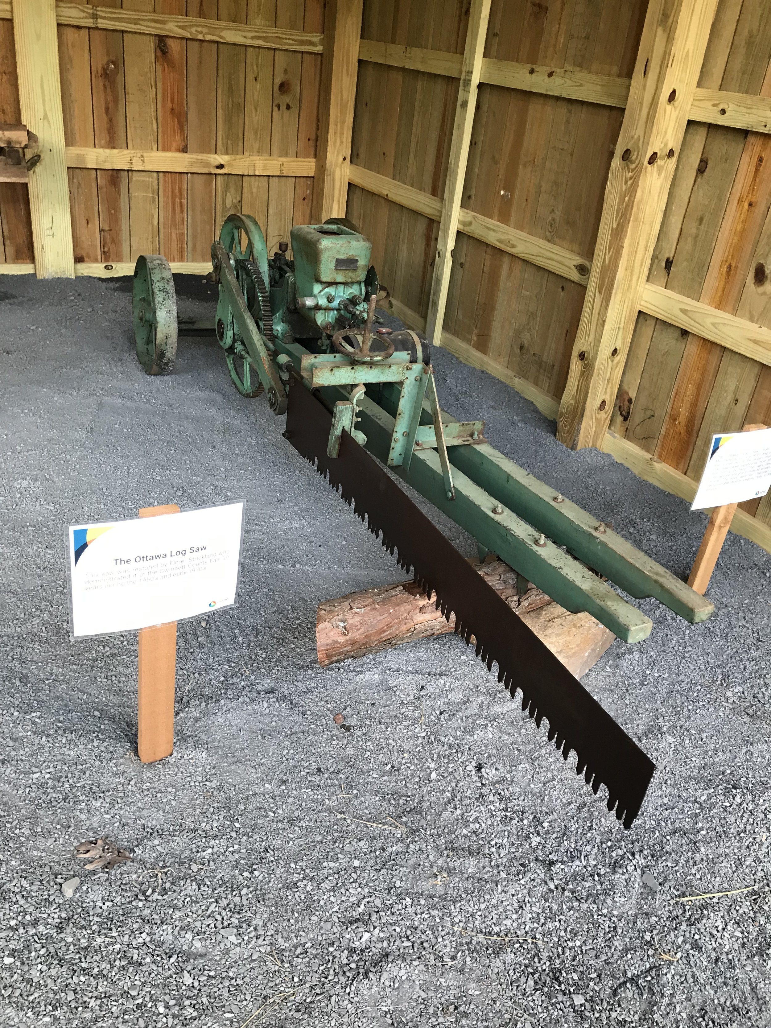
I understand Mr. Varner’s predicament with his family.  They probably all wanted something different to be done with the family farm.  My family experienced a similar incident in 1945.  My 3x Great-Grandfather went from absolute poverty to building a real estate empire.  “Newt” Pharr owned so much property that when his kids sold out his estate it took 3 pages in the Atlanta Journal to list everything.  He owned farms, businesses, and almost every mill on that side of the county.  Tribble Mill, Hugo Mill, the Dacula Electric Mill, Freeman’s Mill were a few of the sites he owned.  When he died, the kids immediately began fighting over the land and money.  In the end, my family owns none of it anymore, and the cash gained has long since been spent.  All those places (with the exception of Freeman’s Mill) exist only as road names now.  It will only be a matter of time before those road names are changed because they are no longer politically correct.  Newt Pharr’s situation was a bit different than Mr. Varner’s because the land wasn’t marketed as one large lot.  All that being said, with the prime price received for the land under the nondisclosure agreement, there will be some consequences.  Neighbors and community members will feel betrayed.  What the sellers have decided at the end of the day is that money is worth more than the community, neighbors, and friends.

There is a counterpoint to the NDA, be a holdout and refuse to sell.  With that comes the possibility of condemnation of the civil authorities.  The government could move in and take your land.  They could pay you “fair” market value as they see fit.  A businessman takes the money and deals with the consequences.  Some refuse to accept the Faustian bargain and instead stand on morals.  Morals don’t come cheap especially when we live in a time of big men and small morals.  The man who stands and fights will probably see a financial loss for his efforts.  If you’re a believer in the Bible you’ll probably recall that “loving favor is better than great riches.”  I’ve had the great honor of knowing some fighters in Gwinnett.  One family I know has been targeted again and again because they hold land.  I can tell you this, I hold that family in higher esteem than I ever will a sellout.  Those that sell may be good people, they may be pillars of the community and leading members of the local church; but in the end they chose money.

I believe it is a land owner’s right to do with their property as they see fit.  When those choices infringe on the rights and freedoms of others, the need for some checks and balances come into play.  You see this in the earliest land records of the area where someone who builds a mill has to ensure they won’t hamper the water rights of those downstream.  To see the State of Georgia take over control of the Rivian development robs local citizens of their representative rights.  We don’t live in a democracy; we live in a Republic.  In a democracy the majority of people can vote to force a solution, in a Republic there are checks and balances to represent the minority of citizens when the power of the majority oversteps or pushes an agenda without minority inclusion.

I’ve been thinking on the local political landscape as well.  After Teddy Roosevelt left office he delivered one of his most famous speeches ever titled “Citizenship in a Republic”, most people know the following quote from the speech.

“It is not the critic who counts; not the man who points out how the strong man stumbles, or where the doer of deeds could have done them better. The credit belongs to the man who is actually in the arena, whose face is marred by dust and sweat and blood; who strives valiantly; who errs, who comes short again and again, because there is no effort without error and shortcoming; but who does actually strive to do the deeds; who knows great enthusiasms, the great devotions; who spends himself in a worthy cause; who at the best knows in the end the triumph of high achievement, and who at the worst, if he fails, at least fails while daring greatly, so that his place shall never be with those cold and timid souls who neither know victory nor defeat.”

What troubles me in thinking of this was a quote by my Commissioner, Ben Riden.  When interviewed by Doug Richards of 11Alive on March 10th he stated “I don’t believe based on the time frames there was really an opportunity to fight it.  I think it was one of those things where, it was a decision was made to move forward and that’s what they did.”  Commissioner Riden then affixed his signature to the document requesting the state take control.  If Mr. Riden felt there was no way to fight it, then he has joined those “…cold and timid souls who neither know victory nor defeat.”  Mr. Riden had the golden opportunity to be a hero in Morgan County by leading the fight; and instead he elected to punt the football.  Many would argue he knows more about the situation than I do, and no doubt he does.  I know he is my representative and from the voices I hear from my neighbors he is not representing our views.  These are all the same stories I heard in Gwinnett as a child.  I remember distinctly one evening my family sitting quietly in the living room as my Dad called Mr. Dodd, our county commissioner, to express his opposition to the Hamilton Mill development.  Mr. Dodd assured my Dad he was voting against it.  The next night as we all sat in the Board of Commissioners’ meeting, I watched as Mr. Dodd raised his hand in favor of the development.  I remember asking my Dad why Mr. Dodd lied.  Mr. Riden and the other politicians have done one thing positive; they have made me active in local politics.  I have volunteered to assist opposition candidates and have taken my children along to experience the work.

At the end of the day I’ll fight the Rivian project anyway I can.  I will make myself more present in local politics (I have no desire to run for office though).  My kids will learn what open requests do and how to hold people accountable.  I’m a new guy in Morgan County.  I came here and was blindsided by backdoor deals.  It was all legal I’m sure; I’d say it was highly unethical and immoral.  Y’all can feel free to disagree with me or make other points and I will be happy to discuss those with you. 

Fort Defiance and the Bulldozers of Rivian

The State of Georgia was unique during the period of the War of 1812 as it featured a British land Invasion at St. Mary’s, numerous conflicts with Red Stick Creeks such as at Hill’s Mill on the Apalachee, and the construction of the world famous Peachtree Road.  As tensions increased across the State’s border, on November 13th, 1813, Governor Peter Early ordered the construction of Forts or Blockhouses at 10 to 20 miles along the frontier.  These forts ranged in style from fortified cabins to fully stockaded walls with firing steps.  Morgan County featured two forts, Fort High Shoals and Fort Defiance.

Fort High Shoals was located near the High Shoals of the Apalachee.  Although it was in Morgan County and staffed with Morgan County Militia, it was commanded by Lt. Isaac Daniel who was based just across the river at Fort Smith.  A similar situation occurred at Fort Defiance as Captain James Barton exercised operational control over Fort New Hope in Jasper County.

The line delineating the United States from the Creek Nation was drawn by the Treaty of Washington in 1805.  It stated the boundary would be “Beginning at the high shoals of Apalacha, where the line of the treaty of fort Wilkinson touches the same, thence running in a straight line, to the mouth of Ulcofauhatche…” This is the same line that today serves as the boundary between Morgan and Walton county.  A small change was made to the extreme west portion of this line with the creation of Newton County.  Two soldiers in their 1812 pension applications refer to this line as “The Dry Line” because it was one of the few boundaries to not follow a body of water.

Given the Governor’s orders, the command structure, and the pension accounts, we can narrow down the possible site of Fort Defiance.  It was located near the original Jasper County line, was close to the boundary line of 1805, and did exist as some type of structure.  To further narrow the possible locations we can use clues from sister forts that were built under the same order.  Forts Daniel and Early were both placed at common road or path intersections.  Forts Washington (Franklin County) Madison (Franklin County) Daniel (Jackson County) Early (Jackson County) Smith (Clarke County) were located on high ground so as to command the surrounding land.  All the prior listed forts, with the exception of Fort Smith, also were known to be areas of common Native interaction.  By assimilating these clues with the known details of Fort Defiance the most likely scenario is that it was built on a hill, near the Morgan county line and the Hightower Trail.  Using that hypothesis the Fort Defiance site is most likely one of the hills on Davis Academy Road or the surrounding land. This is the Rivian site.

The rediscovery of Fort Daniel in 2007 through the current day gives an archaeological and historic blueprint for conducting this effort.  As outlined in the writings of Dr. Jim D'Angelo, a scan of the area with a metal detector to pinpoint possible period artifacts can inexpensively narrow the search.  At Fort Daniel once several period artifacts had been discovered, mechanical scraping removed the brush and a more detailed archaeological excavation commenced.  For the first 24-30 inches (commonly known as the plow zone) an array of artifacts was discovered. Beyond the plow zone staining from the fort’s stackage walls was visible and many more artifacts were discovered.

In the initial zoning application to Morgan County (before the State took over the project) there was a wanton lack of historical or cultural resource information. I reached out to every one of my elected representatives and only received one response which was lack luster in its advice. We will soon see the bulldozers of Rivian destroy these artifacts and maybe countless others. The lack of due diligence once again destroys the story of European interaction with Native Americans.

Fort Defiance tells an important piece of Morgan County’s History and the minimal effort needed to do a rough archaeological survey is well worth the time spent.  The Story of Native American interaction with European settlers should not be lost.


Here are a few of the records on the site.


Description of a Jasper County Militia man who was held back to defend the frontier while others of the Militia marched into the Creek Nation.

A letter to Zoning and Planning Morgan County, Georgia.

Below is the test of a letter I sent to my Comissioner, Ben Riden, and to the Zoning and Planning Director. I wanted to post it here so the documents I sent them would be easily accessible and shareable. The buttons below my letter will link you to the pdf files I sent.

Mr. Riden, et. al.,

Attached please find a sampling of some research I have done over the past 6-7 years that will be impacted by the Rivian site and GDOT Project No.P.I. No. 0018361. In that time I have been researching the events and location associated with the War of 1812 (and the Red Stick War) in the areas north of Fort Hawkins (Macon, GA). On November 9th, 1813 Georgia Governor Peter Early ordered the construction of Forts at 10-20 miles along the frontier as protection. You can see a sample of these forts by visiting the Fort Daniel site in Gwinnett County. (i'll encourage you to go to www.fortdaniel.com)

Morgan County had 2 forts constructed under the Governor's Orders, Fort High Shoals and Fort Defiance. Fort High Shoals was located at High Shoals (across the River from Fort Smith) and Fort Defiance was located at the Native Trail connecting to the Hightower trail on the 1805 Treaty line which is within the Rivian site. I am attaching a few samples of documents from my research. The "Incursions into Morgan County" and the "Ambush" give location context to the conflict in the area.The "June 8th Transcription" details the services of the two spies stationed at Fort Defiance. Spies were more like rangers in 1812. The "Roster Fort Smith" is the roster of men who were stationed opposite Fort High Shoals. A similar roster exists for Fort Defiance at the State Archives , but i do not have a copy of it. "Settlers" is a list of those people who illegally lived in the area before the Treaty lines were extended. The "1814 Spies list" details the spies who were station at each Fort. and the "Accounting records" are a sample of the vouchers used by the state to pay for supplies for the Forts.

Again, these items are only samples of my research which is only a fraction of the information available for the location of the Rivian site and GDOT project number P.I. No. 0018361. As you consider zoning, construction, and cultural resources I hope you will ensure we save the Fort Defiance site, the associated Muscogee Creek Trail, and ancillary items that will be discovered along the way. I will be happy to assist in explaining my research, sharing documents, or directing others to the proper resources to fully interpret the site culturally and historically.


Thank You,

Eli Stancel

A few stops in Morgan County

I took the kids on a drive yesterday. Since we wanted to give mom a little room to clean without Vera, me and the 4 kiddos loaded up and took a trip across some backroads. On the way out of the driveway we stopped briefly to visit with the red shouldered Hawk that has taken up residence in the front pasture. There is actually two of them so hopefully we’ll see some babies come springtime.

First we cruised down Echols Road. Its a nice little farm road. We stopped and took in a vista of downtown Bostwick from across a chopped cotton field. It was a peaceful setting. Its a short street and we then took a right onto Paxon Dairy. We passed by the old dairy. When crossing Bucks Creek just below the dairy we were able to see where the old road has crossed. the depression in the hillside and the low bridge abutments told of an earlier route. The road brought us to a dead end and we took the left onto Price’s Mill Road.

Price’s Mill is an old road. Although we did not drive all the way to the site of the Mill on the Apalachee River you can see how the road follows the contours of the land. The route to the old mill also carries a bit of history. At Price’s Mill, and down this road, Jefferson Davis and members of the Confederate government moved in the waning days of the war. Union troops were closing fast on Davis and their records showed that after crossing the Oconee down stream, they moved North and crossed the Apalachee at Price’s Mill before continuing their drive for the Trans-Mississippi.

Before getting to the old mill site, we turned right onto Wagon Mill Road. At this juncture there is the old Rehoboth Cemetery (alternatively spelled Rehobeth). The cemetery appears to have been established around 1809. That date makes it one of the earliest in the area. 1804 was the first treaty line that included this land in the territory of the United States. Burials in the cemetery span from the early 1800s through 2019. A name that appears with recurrence in the plots is Launius. One of the older roads in the area still bears that name.

As we travelled down Wagon Mill road, the farms gave way to timber land. Some distance into the timberland we crossed Jacks Creek on a nice little bridge that afforded a wonderful view of some shoals. I have not searched yet, but judging by the old road bed, it appears this could have been the site of a mill giving the road its name. It was a most lovely spot and just a mile or so downstream from Jack’s Creek Tree Farm. As we climbed up out of the valley we again came to farms and rolling pasture. At the end of the road we took a left onto Apalachee Road.

As we drove toward the small community of Apalachee, we were paralleling the old Green County Railroad bed. The tracks were tore up years ago, but at one time a line ran from Apalachee (where it connected with the Central of Georgia) to Monroe via Bostwick. The old tracks in Bostwick would have ran behind the Cotton Gin and across the Sod farm. The name of the railroad is a bit misleading because the intended routes to Greene County were never completed. Arriving at Apalachee the old Central of Georgia Tracks were still in place (some to the rail there dates to 1897). We stopped at the old Apalachee School. The school is only open to the public on special occasions so we walked briefly around the exterior and took in the the historical marker before jumping back on Lower Apalachee Road. We followed the old Railroad and saw the trestle over Hard Labor Creek before we had to make a left turn onto Briar Creek Road. Apalachee road is closed at the old railroad crossing because of a failed bridge.

Briar Creek Road offered little in the ways of scenic vistas because of the heavy timber. We did see a hunter who had taken advantage of a deer’s poor choices that morning. We arrived at Greensboro highway and headed toward Madison. The return to Home in Bostwick was fairly uneventful and the house had been fully cleaned and prepared for Jude’s party. It was a nice trip through the countryside. I hope to take many more. I hope to locate some of the 1812 forts along the 1804 treaty line. I’d like to find the battlefield where some Georgia Militia Dragoons were ambushed by Creek Indians on the banks of Sandy Creek. I’d love to find out more and more about the area. Below are some photos from the drive. Eleanor took most of the photos, so she gets the credit.

Eli

State Archives Scans and the Rowen Foundation

I was reviewing the Rowen report and found myself really frustrated. I know I wear my heart on my sleeve when it comes to the land and the people that were there, so forgive my passion. The report contained little new research and a disappointing treatment of Native American culture and history in the area. The entire Appalachee has long been a place of Native American presence. Before intense European settlement, the Cherokee had began to push the Muskogee (commonly called the Creek) out of the area. Within the Creek nation there was also division in the Lower and Upper Creeks that manifested in a Civil War of sorts. All of these forces were coming to bear when the United States began to expand their territory across the Appalachee which had been the national border as outlined in the 1790 Treaty of New York. I feel like Rowen could have used some of the written sources from that time to give a better perspective of the area. In the Area below the Lawrence Road/Brown’s Bridge Road over the Appalachee is an area known as Tanner’s Bottoms. For decades this area has yielded a number of articafts. The Rowen Report even mentions a point in the research. This area should be investigated further.

Rowen did not have to go far to do this research to make it part of the report. The National Archives and the Library of Congress have some fair information, but the Georgia State Archives in Morrow has in their possession hundreds of original source documents from this time period with specific references to the area. Making it even easier, in the 1930s the WPA typed up these documents and they are available for review at the State Archives and a number of libraries around the state. I’m betting the University of Georgia even has copies which would have meant the resources needed were mere feet from where the report was prepared.

Should you wish to read some of the WPA typed documents of the original versions, I’ve included a link below. Keep in mind these have pages are only a sampling of ones that I have done personally for specific topics important to me. The Creek and Cherokee letters collection is much larger.

Hope you Enjoy,

Eli

4th Sunday in May

For years one of the most special times of the year for me was late spring. It means Homecoming at Duncan’s Creek Church. We called it homecoming, but more often than not we referred to it as “4th Sunday in May” reflecting the date when it is help annually. I remember as a child that there was no room to sit in the church. Service began at 10 and went until noon. It was one of the few times we did not have Sunday School. The morning was filled with a variety of Hymns and Special songs separated by prayers and reading the names of those church members who had passed in the previous year. People and families would return on this day annually to revisit the church that had influenced them or their family.

One of the more unique parts of the morning was when we went to the cemetery. Usually about 45 minutes into the service the meeting recessed and all that were physically able walked to the cemetery. Led by the choir director we would sing “When the Roll is Called up Yonder” and a prayer would be offered. When I was young maybe one or two cars would pass down Highway 124 while we were singing and I wondered why those people were not in church or how anyone in the world didn’t know about “4th Sunday in May.” These days the roar of automobiles can almost drown out the heavenward tones as they speed past during the song in the cemetery.

Next, the congregation would return to the sanctuary and complete the service. The morning services was concluded with a sermon delivered by the current pastor. As a kid, this was the longest part. Not that I was bored by the pastor, but my mind and stomach was thinking heavily about what happened next…dinner on the grounds. Dinner on the grounds was and is an experience you can never fully appreciate if you were not brought up with it as part of your ethos. There is something special about the hours of preparation, the quality and quantity of food that makes a young boys heart leap with joy unspeakable. I was able to walk through entire tables of homemade cakes and pies and while my mother was distracted with perfectly placing her dishes I could make a game plan to attack the fired Okra that had been brought by at least 12 different families. The meringue on Lemon icebox pie just tastes a little sweeter on 4th Sunday in May. As the years pass the amount of food is smaller, as is the crowds. But to tell the full truth, I still seek out the fried Okra. Calories don’t count on 4th Sunday.

A tradition that has ceased in recent years in the afternoon shaped noted singing. I have written about those singings in a earlier post, but I can tell you a finer group of sight readers never existed. To hear people from all reaches of Georgia and the Carolinas singing with all their heart…and on pitch was awesome. That too has faded with time and the recent challenges of Covid. Last year, for the first time that anyone remembers, 4th Sunday didn’t happen. Covid forced the congregation to make the tough decision to call it off. I’d still say it happened in a way. The Reverend Dr. Dee Dillin recorded a message from the pulpit and sent it to the congregation. So in a small way, the tradition continued. I’ve dropped a link to that sermon below if you want to give it a listen. A unique thing you can see in the brief video intro is the grave of William Holman. He was a soldier in the Confederate States Marine Corps and is buried at the church. The rarity of Confederate marines makes that spot a little extra special on the approach to Memorial Day. In 1965 Mrs. Burel put together a brief history of the church. I’ve included that in a link below the video. She does neglect to mention the time a fight broke out about scriptural interpretation in the church pulpit in the late 1800s. Pull me aside sometime and I’ll share that story with you.

This Sunday I will wake up and pull out the gray suit and bow tie. I’ll tune up my Martin and warm up my voice. I’m excited because this year, we’re meeting again. Should you find yourself free this Sunday about 10am, come on down to Duncan’s Creek Congregational Church. You’ll hear the hymns, walk to the grave yard, and take in the sermon. There is no afternoon singing anymore, and this year we are still holding off from celebrating dinner on the grounds. But if you are inspired after the service and need to keep the fellowship going come on over to the house because we’ll be having a big meal to reflect on the day. I’m excited for Homecoming, I’m excited for 4th Sunday in May.

Finding an Ancestor- Request from a Reader

I received a request about 2 weeks ago. It went like this.

John W. Pierce 30 Mar 1837 - 17 Jan 1864

“Hi Eli, Thank you for your many interesting but educational stories of history. The above subject is my GGG Grandfather who was in the Civil War and lived in Gwinnett County Georgia. My Grandmother never knew anything about her family. A Mrs. Ova Warren (Demorest, GA) had this written down for my Grandmother in 1959. This is basically all the info that my Grandmother had. By looking at his death date, I believe he died in the Civil War - but no proof. I'm not sure what company or unit he was in. Do you know how I can find this or if you know someone who might be able to help me with this? Thank you for your help.”

So the first thing I did was to dive into the known records. I started a spreadsheet and tracked names, dates, service records, and pension records to help me narrow down the search. I found several John Pierce (also pearce) and also a couple of John W.s. The best source was the 1850 and 1860 census. The 1850 census has John W in the house of Lovick Pierce in Gwinnett County and the 1860 census placed him in the Chestnut Mountain portion of Hall County still living with Lovick. The 1870 census has a John W nearby in Jackson, but the birth date would have been 1832 for that particular individual. Just to be sure I tracked John W Pierce born in 1832 and found his death was after 1900 and his burial site is in Houston. That helped me exclude him from the search.

Going back to the John W Pierce born in 1837, he appears to have married a Nancy Carter between 1860 and 1861, but I have not found their marriage record yet. They did have a son named James William Carter Pierce born in July of 1861. The probably meant John did not volunteer for Confederate service early in the war. Since John disappears from the record I traced Nancy. She Married William J Phagan in 1868. I traced William’s record and he was almost a decade younger than Nancy. He also outlived Nancy and remarried about 2 years after her death. He served in the Georgia Militia for 6 months and his pension went to his second wife so there were no clues there. Nancy could not claim John W’s pension because she had remarried and thus there was no pension application for John W. Pierce.

I took a look at the 1864 Georgia Militia census. In 1864, Governor Joe Brown took a census of all men and the arms they owned in case he needed to call on them to defend Georgia. I saw Phagan and the 1832 John Pierce, but the 1837 John W Pierce was not on the list in Hall or Gwinnett. Using these clues I figured that John W Pierce had joined confederate service between 1861 and before 1864. Cross checking those dates against his name on rosters narrowed down my search.

While I was at this stage I remembered something. Lovick (john w’s dad) was the son of Wiley Pierce. I went back to my War of 1812 files and found Wiley. He was a private in the Georgia Militia in 1812 and helped build and staff Fort Harrison which was a fort built near Flowery Branch Georgia. A neat connection I thought. Anyway, back to John W Pierce.

Fold3.com provides some nice search features so I used that platform to to look for the data I desired, but all the same documents are available through the National Archives and if you use the Mormon’s familysearch.com website you can drive down to the full details. Its free and very useful to historians and genealogists. In those records I think I have found John W Pierce.

There is a record for John W. Pierce who in Company B of the 66th Georgia Infantry. The file is only 4 pages long, but some facts in the there combined with other details give me 85% confidence that this is the right guy. Of great use in developing this confidence was Daniel Cone’s book “Last to Join the Fight: The 66th Georgia Infantry.” The 66th was not created until 1863 which matches with the dates for John W. Pierce. It was also unique in that the men in the companies of the regiment were a mix of various counties from Georgia. This is in juxtaposition to early war enlistments where most companies came from the same county or community. The 66th had 13 men from Hall and 13 men from Gwinnett and overall represented about 100 counties. The unit saw extensive action in the Atlanta Campaign so the dates provided for John W. Pierce’s death match the time between Kennesaw Mountain, Peachtree Creek, and Atlanta’s battles. ( I got excited and made a research error here. John’s death date was listed as January, not July as I though so he was not present at these battles. A mistake of my fast paced research-edited 4-20-2021)

Page 2 of the service record state that John W. Pierce enlisted on July 24th, 1863 at Decatur Georgia and was mustered in at Camp Cooper-Macon, Georgia. This matches the research in Cone’s book as Company B was a diverse company of counties. Decatur would have been the main junction of roads for most points from the East so that location makes sense for a soldier from Hall or Gwinnett county.. Page 2 also states that John W Pierce was 26 years old, that matches the 1837 birth year. Page 3 and 4 of the document tell us that John W. Pierce died in 1864. We know this because those pages tell us that his name was on a registered of deceased Soldiers and that he was still in possession or was owed about $30.00. The date was 1864.

What could further increase the confidence here is to use the National Archives records via the familysearch.com microfilm record (available online for free) to comb through the actual roster for more detailed clues. the service cards on file with the national Archives are really a summary of those original documents. But those documents are thousands of pages. That research takes time. I’ll try and put up a tutorial on how to use these items in the near future..

So in conclusion I believe I would say we have found John W. Pierce’s Service. He was in Company B of the 66th Georgia Infantry and he died in 1864. The 66th served in North Georgia during the times that Pierce was listed as dying. Given the winter date of death (January 17th, 1864) and the lack of major engagements after Tunnel Hill in 1863 I would surmise he was a victim of disease as the unit was wintering in Dalton, GA. But that theory could easily change with one or two lines of text from firsthand documents. Combing through those individual returns in the National Archives could prove more fruitful.

Hopefully you all find this enjoyable and useful. And as always, send in your questions and thoughts using the “contact me” button at the top of the page.


1850

1850

1860 Census

1860 Census

Nancy Carter and William Phagans (Fagans) marriage

Nancy Carter and William Phagans (Fagans) marriage

A 1930s Militia map of Georgia.  This can be useful for matching census records to locations.

A 1930s Militia map of Georgia. This can be useful for matching census records to locations.

Microfilm record details from the National Archives; the roll numbers are useful when accessing the records.

Microfilm record details from the National Archives; the roll numbers are useful when accessing the records.

This caption from John W Pierce’s summary file tells us which records his details came from.

This caption from John W Pierce’s summary file tells us which records his details came from.

Summary Card of John W Pierce’s service detail.

Summary Card of John W Pierce’s service detail.

Enlistment detail.  This would be a summary of a record held by the National Archives.

Enlistment detail. This would be a summary of a record held by the National Archives.

Records of John W. Pierce’s property collected by the CSA Quartermaster after his death.  The full record would be in the Archives.

Records of John W. Pierce’s property collected by the CSA Quartermaster after his death. The full record would be in the Archives.

Here is the final page of his record and the date is a great find here.

Here is the final page of his record and the date is a great find here.

Wiley Pierce (John W Pierce’s Grandfather) on a roster for Georgia Militia in the War of 1812.

Wiley Pierce (John W Pierce’s Grandfather) on a roster for Georgia Militia in the War of 1812.

A reminder of the War

My aunt and uncle were cleaning out an old home in Dacula and came across a list which they gave to my parents. It was an old typed list of Confederate soldiers buried at Ebenezer Church in Harbins. Many of the names were familiar ones to the community. It also had some notes about the various units that men from the area served in during the war. I saw the 42nd Georgia and the name Freeman which reminded me of a moment from a few years back. While traveling for work I was in Salisbury, North Carolina. Salisbury is an old town. It was a stop on the Great Wagon Road when that area was still part of the British Empire. The town was fought over during the revolution and General Greene got a great deal of help from one of the local Patriots. During the War between the States it was a vital supply center and the home to a POW camp. In more recent times Cheerwine has been the main feature of the city. It was while waiting for track time at work in this town that I stumbled across the Old Lutheran Cemetery. In that burying ground are a number of leading town citizens and on the edge a scattering of Confederate soldiers. One of those soldiers was Private James Freeman, Company B, 42nd Georgia.

James was born in 1833 in Gwinnett county and when the war erupted he joined the 42nd Georgia leaving his wife and one year old daughter behind on May 12, 1862. The 1862 enlistment date reflects a bit of Gwinnett’s hesitancy in the war effort as the county was not as firebrand as other areas of the state. He was in the southern and western theaters of the war and was captured at Vicksburg. After his parole at Vicksburg he cam home for 6 months. After that his record goes dark for a while. The 42nd, as a unit, was engaged in the Atlanta Campaign and after the Confederate Army of Tennessee was decimated by the leadership of John Bell Hood, they moved east and were to face Sherman in the Carolinas at the close of the war. That’s where James Freeman comes back in.

In the old Lutheran Cemetery he is buried. The last entry of his service record reads “General Hospital Number 10, Salisbury, NC. Disease “ VS Right Breast. Died March 17, 1865.” Salisbury was the last stop for many. Hospitals were not capable of the best treatment during the war and whatever the details are we many never know. After James passed, he was interred at the cemetery closest to the hospital. His daughter went on to grown up and got married. She had 8 children and so his line continues to this day.

I cannot imagine the suffering felt by any of the citizens of this nation at that time; Weather as slaves or freeman, as soldiers or citizens, as wounded or dying, as fighters or prisoners. We should be beyond thankful for the sacrifices of prior generation. We live in the most prosperous time of written history in a land of Freedom. Not a perfect land, but a pretty good one…It would do us well to remember that often.

CSA Soldiers at Ebenezer Church in Harbins

22103704_119214249555.jpg
James Freeman.JPG

A Lucky Find-an old Song Book

I was reviewing some research for another project i’m working on and needed some firsthand material. Google has been good enough to digitize some old books and after I read the selection I was interested in i did some random work looking up old songs. My wife is related to the great songwriter James McGranahan (Showers of Blessings). I found several of the song books he had written and some he had edited. While reading through the book i came across “Walking With Jesus” by Harry Brooks written in 1901. It looked fun so I took a stab at it. I’m a Bass and the high end is tough; perhaps I should have changed the key from B flat. So below is my poor rough shot at the song.

The Battle of King's Tanyard.

I’m slowly starting to do some research on the local battles. King’s Tanyard was the site of the heavy skirmish on what is now the Barrow County/Jackson County border. After General Stoneman’s (USA) defeat and capture at the Battle of Sunshine Church, portions of his force broke out and tried to escape or fight their way back to Union lines. Colonel Horace Capron (USA) and Colonel Adams (USA) were able to meet up and then decided to attack Athens. They were thwarted in that attempt by the home guard and some invalids while also being pursued by Confederates from the Sunshine Church Engagement. Leaving Athens they took different roads and Capron took the wrong road which led him toward Jug Tavern (present day Winder, GA). A number of slaves began following Capron’s cavalry which further slowed his escape. IN the late night of August 2nd, 1864 Capron allowed his men to take a few hours nap near King’s Tan Yard not far from the County Line School house. In the predawn hours of August 3rd, elements of Williams’ Kentucky Brigade (CSA), also called the Orphan Brigade, surprised the sleeping Yankees quickly overrunning the pickets. Capron’s troops were also at a disadvantage because over half of them had lost their guns escaping from Sunshine Church. The engagement became a running or moving one as the Federal forces performed a fight retreat moving downhill towards the Mulberry River. The panic of the escaped slaves and unarmed Union cavalrymen led to a mass of people on the bridge over the river which failed under the weight. Capron and 6 men escaped back to union lines.

I will continue to share more of my research as i get it cleaned up including soldiers involved and such. I have noticed a lot of error between Confederate and Union sources as far the treatment of the captured Yankees and the causalities of the battle. Attached is a photo of a portion of the widow’s pension for James Parker of the 14th Illinois Cavalry, you’ll noticed in the description he was captured at Mulberry . As I develop these research points I will share them. Below is an article from a local paper describing the incident.

“May 24, 1901—Battle of King’s Tan Yard—General Stoneman was raiding Middle Georgia and met Major General Williams of Kentucky, who defeated him at some point north of Macon. General Stoneman retreated in the direction of Athens, and in passing out of Watkinsville he asked a little girl if there were any soldiers at Athens. She replied “Yes, sir, lots of them” when the fact of the matter was far different. Captain Ed Lumpkin, hearing of General Stoneman’s approach, with his company had placed his battery of artillery in position at the papermill, so as to cover the road in the direction of Watkinsville. As soon as the head of the column of raiders made its appearance, Captain Lumpkin opened fire upon them, and Stoneman turned his course to the left, and coming into Jackson county, encamped for the night at King’s Tan Yard. General Williams pursued, after defeating General Stoneman, and overtaking him at this camp about daylight, completely surprised him, and in the fight which followed, killed a large number of the Federals and took 500 prisoners. The Federals retreated, but kept up a running fight from King’s Tan Yard to Price’s Bridge, a distance I suppose of five or six miles. Many of them, in their frantic efforts to escape, forced their horses into the Mulberry River, and were killed while vainly endeavoring to urge them up the opposite bank. General Stoneman escaped, and made a beeline for Atlanta. King’s Tan Yard is near the Jackson/Gwinnett line, on the place owned by Mr. Richard Pentecost, and the bullet holes in the walls at the old building are there today. Prices’s bridge is about one and a half miles south of Hoschton over the Mulberry. This the only battle in the War between the States which occurred in Jackson county. “

Parker, James (WC123963).jpg

A few Shots from this week.

I spent a few afternoons strolling around Seven Islands State Birding Park. It is a nice walk along the French Broad River with some hard surface trails and grass/natural surface trails. The park is kept groomed for wildlife so plan to enjoy deer, rabbits, and a variety of bird species. The park is off exit 402, Midway Road just East of Knoxville on I-40.

Dinosaur Party, Folk Art, and the Waffle House

On Saturday we went to the Gwinnett Environmental and Heritage Center for the Dinosaur Party. In addition to the usual exhibits, the event featured a number of dino items and with Jude’s recent fascination and a cost of “FREE” i don’t think we could pass it up.

I have run the trails around the site a lot in the past, but have never been in the building. There is a wonderful display of exhibits. As always I was drawn to the local history, but the water room was excellent. The display was geared to kids interactive exposure. There was an image overlay topographic sandbox, I was more excited than the kids about that one. Several stations explained water filtration and and the various portions of the water cycle. You can ride a bicycle that is geared to transport water about 10 feet up into a bin to explain pressure. A kid level water table allows for the explanation of water flow and how a mill operates at a fall. It is a good learning activity.

The kids enjoyed the dino items. One interactive exhibit had a dino bone that the kids had to reassemble. Isla took the opportunity to dress up as a dino and sit on a nest of eggs, with a very effective growl I might add. Eleanor enjoyed magnification of shells and any craft related activities. The displays were kid friendly and most of them encouraged touching. The cut aways of eggs was really unique to see.

In one room there was a series of bones, reconstructions, and activities hosted by the Paleontological Association of Georgia. What made this group so wonderful was passion. They were volunteers who do these type of engagement events because they love it. There fine people were the most informative and engaging of anyone at the dino portion of the show. They took time to answer questions, explain fossils, and give examples. I hope when I do living history that people feel the same way this group made me feel. There was palpable enjoyment in their education. To see Jude stay so focused on an adult talking about dinosaurs was an image that burns in my mind.

While we moved through the building i took time to observe the permanent exhibits highlighting Gwinnett’s history. Gwinnett had done a good job of presenting the story line in these exhibits. There was a number of unique artifacts from Gwinnett’s history. I got to show Eleanor some of Gid Tanner’s items and remind her she went with me to his Grandson’s house for some guitar work. Isla enjoyed being able to touch so many items. The displays have dozens of old photos and I got to show Jude a picture of my 3X Great Grandfather who ran a Hat factory in Gwinnett in the 1860s.

The line to ride the Dino Tram was extremely long and we were able to persuade the kids that they could either pick a tram ride or a restaurant, they selected a restaurant. First, we walked through the Chesser-Williams house and the associated farming displays. The barn was off limits account 2 vultures had decided to nest within its environs. The shed behind the house contained some well preserved farm equipment. An old farm engine, a pea thrash, corn sheller, Meadows Grist Mill, and an Ottawa cutting saw. I was most excited about touring the house and finding the apple.

The 1800s house is unique not only because of its age, but also because of its decor. When a travelling German Artist came though in the 1800s, he traded room and board for his painting services. The painter covered the front exterior and the first two interior rooms with art. Through the years the paint remained and is now a fine display of American Folk Art. Before Gerald and Sue Williams donated the house to Gwinnett county, my parents got to walk though it at the original location. Gerald showed my parents the room he slept in as a child, it had a string of apples in place of crown molding. There was one apple that Mr. Williams said he would stare at from his bed every night, it had a bite taken out of it. The docent that was serving as host was friendly and knowledgeable. When most of a group had moved through she saw Eleanor staring at a piece of furniture in the kitchen. She asked Eleanor “Do you know what that is?” Eleanor replied “Its a pie safe, my Daddy has one of those.” You could tell the host was genuinely happy she knew the answer and she then prompted us to walk onto the back porch. She asked the kids “do you see that black metal thing on the roof, what do you think that is?” Without missing a beat Jude replied “Lighting rod!” I couldn’t have been more proud.

We departed the site and returned to our vehicle. The tram line was getting even longer and a dinner suggestion was needed. Waffle House received a rousing cheer from the kids and so we concluded our journey at that fine establishment. All in all it was a very enjoyable time. I’ve included some pictures and a link to a video of Mr Gerald Williams. Here’s to more fun adventures.

Link to Mr. Gerald Williams https://www.youtube.com/watch?v=UAHndXsiub0

Redcoat Skeletons, Nancy Hart, and Family Video.

               Steph was spending her last day in Colorado with longtime nursing friends on Monday so the kids and I made our way south of Elberton.  A local DAR chapter reached out to us about being in a small film production concerning the life of Nancy Hart.  Admittedly, I was a bit surprised that many long time Georgians had not hear her story.  Nancy lived in a cabin on Wahachee Creek about half a mile from its confluence with the Broad river; near the border of Elbert and Wilkes County.  In the period of the Revolution this area was a place of civil unrest.  Allegiances could change overnight, and often times Whigs and Tories were motivated by feuds and monetary interests as much as they were governmental loyalties.  The kids and I got dressed up and headed out Anyway, the legend goes something like this…

               Several Tories found their travels taking them to Nancy’s Cabin.  In the time that followed they were either invited or self-invited into the cabin for drink and food, possibly including one of Nancy’s Turkeys.  As they spent their time with the refreshments, Nancy found opportunity to begin passing their firearms through a hole in the wall to her daughter outside.  The Tories discovered the action and rose to stop her.  Nancy fired upon one killing him, then held the others at gun point with their own guns.  She then turned them over to the local militia.  The militia was split on whether to shoot them on the spot or handle them otherwise.  The Whigs decided to hang them and marched them a short distance away where they were hanged and buried.  How much truth is in this? Well, let’s see.

               George Gilmer in his book “Sketches of Some of the First Settlers of Upper Georgia” attest to the cabin’s location with firsthand knowledge and confirms her Patriot beliefs.  Gilmer also describes her as a cross eyed, redheaded woman with a reputation as a bit of an herbal healer.  That takes care of her cabin’s location and her political leanings.  Now what about the incident.  On the 17th of September, 1825, the Milledgeville Recorder printed a story on Nancy, it was also run by several other papers.  If you wish to read that the link is below.  Now what about the Tories?   In 1912 the Elberton and Eastern Railroad was under construction.  This line would connect Elberton to Washington and its route generally paralleled State Route 17.  While digging one day 5 skeletons were found in a row, buried 3 feet deep and it came to be discovered that these were the Tories from the Nancy Hart story.  Below are several newspaper articles about the discovery.

               I have always enjoyed genealogy and reenacting or living history.  I don’t really care for the fancy show of satin or polyester uniforms mimicking wars past.  I like wool, linen, and cotton; the real stuff.  The smell of black powder burning as the smoke dissipates from a gun and the dark stains that cover your hands.  I like the sweat of really experiencing the event.  I was so fortunate to be able to serve in the filming as a Provincial Soldier, one of the Tories.  Although most of my ancestors were Patriots, I know of one that fought for King George and was hanged at Ninety-Six, SC.  Wearing the red coat gave me a sense of his allegiance.  Thinking about the Tories at Nancy Hart’s cabin I wondered what ever happened to their bodies after they were unearthed.  The search is on.

               I could find no reference to where the bodies were placed after they were found by the railroad crews.  I decided to use the limited knowledge I had gathered to determine a possible final resting place for the Tories.  Let us start with the facts we know.  We know Nancy Hart’s rebuilt cabin stands near where the original was on Wahachee Creek.  After Capturing the Tories they were hanged anywhere from near the cabin to 2 miles away from the cabin.  The newspaper articles in 1912 give us the data that the hanging site was about a mile from the Hart cabin and hear the mouth of Watachie creek.  Several of the newspapers say the skeletons were found in an area known as Heard’s Field.

               You’ll see a number of pictures below that I used to support my thoughts, but here goes nothing.  First, I drew a circle that was 2 miles from the Hart Cabin.  Next, I used old US Geological Survey Maps to identify the route of the Elberton and Eastern railroad.  Since the railroad only operated from 1912 until dismantled in 1935 the window was limited.  The 1970 Jackson’s Crossroad Quadrangle proved useful.  The old railroad grade is noted in that quadrangle and I focused on the section of the railroad that fell within the 2 mile circle.  At the little Community named Bell there is a small square labeled “CEM” for cemetery and the railroad runs directly through it.  Using an overhead map the cemetery lies on Bell’s Ferry Road.  James Bell received a grant for this land in 1794 so that helps associate the name.  Bell was a station stop on the railroad 11.3 miles south of Elberton.  The National Archives has the railroad valuation maps for the Elberton and Eastern, but they have not been digitized.  The Georgia Archives has a photo of the rail bridge over the Broad River, but not much else.  I searched the Elbert County records and found that that one small square marked “CEM” is listed as a cemetery on the Tax Rolls and is under the ownership of the Universal Church in Elberton. Find a grave does list the site as the Universalist Cemetery and there are several Markers there, some of which predate the railroad.  This could be a possible sport for the burials.  Some of the newspapers mention people coming out of Elberton to see the skeletons although they reference the site being 13 miles south of Elberton which would place it south of the Broad river.  That matches Gilmer’s account of Nancy Hart wading the Broad River with the Tories at gun point.  This means the site could be between the broad river and the community of Norman on the rail line.  A review of the valuation maps would be most helpful so maybe one of my friends in DC can pull those for me.  Who knows, we might rediscover the grave site yet.

                All in all Monday was a great day.  The kids did wonderfully and had a good time being in the film.  I was privileged to make the acquaintance of Sean Liam Wallis.  Sean is an exceptionally professional living historian.  He is the type I really enjoying working with as he cares about the details, the commands, the true feel of the time.  I owe him a debt of grace for his patience as I tried to translate 1812 commands into Revolutionary War commands in my head, I don’t think I did too poorly.  I was also supported by Jesse Tarver who portrayed our officer that day and was kind in his treatment to all.  John Hyatt almost made me fall out of character several times as he and the other patriots (including my father) walked us to the gallows.  My Mom was wonderfully helpful and loving as always taking care of the grandbabies while I portrayed a Tory.  She is the most helpful Nana ever. Papa Wolf looked splendid in his Patriot clothing.  It was a good day.

Pay no attention to the Redcoat with the wrong gun.

Pay no attention to the Redcoat with the wrong gun.

Old Railroad Grade on the 1970 USGS Map

Old Railroad Grade on the 1970 USGS Map

2 mile circle from the Hart Cabin

2 mile circle from the Hart Cabin

Atlanta Constitution 1912

Atlanta Constitution 1912

Danielsville Monitor.jpg
McDuffie Monitor.png
Valuation Map Record from the National Archives

Valuation Map Record from the National Archives

Possible Grave site USGS.PNG
CEM Public Record.PNG
Athens Banner.PNG
Redcoat and Rebel
1914/1915 Picture looking from Wilkes County into Elbert County at the Railroad Bridge.

1914/1915 Picture looking from Wilkes County into Elbert County at the Railroad Bridge.

Link to a Savannah Reprint of the Milledgeville Recorder’s Story on Nancy Hart.

https://gahistoricnewspapers.galileo.usg.edu/lccn/sn87062327/1825-10-06/ed-1/seq-2/

Puckett's Rock

Today as my wife and daughters went with my niece to see an enjoyable production of sleeping beauty, me and Jude spent the afternoon with my nephew William. I left it wide open for whatever they desired. Initially they just wanted to drive around Nana and Papa’s house in the gator, but eventually Jude decided he wanted to fire the flintlock. Although offered many times, William chose not to participate although he was a worthy sideline encourager. Jude has always been sensitive to loud sounds so I was a bit shocked when I repeatedly reminded him of the noise. We got out my 1806 Baker Rifle and loaded it up. The Baker was the rifle of the British infantry in the early 1800s. It was unique in that it was built so that it could be fitted with a sword bayonet so the troops could fall in with the British Redcoats carrying the Brown Bess and fight as line infantry if it was not being used as a skirmishing weapon. Jude got in position and pulled the trigger. Spark, Flash, BANG! The gun performed wonderfully. Jude initially stepped back and covered his ears, then started jumping and smiling yelling “I did it, I did it"!” Couldn’t be more proud.

Next the boys decided a playground was in order. Since rain was coming in wen ventured a few miles north to Cherokee Bluffs. I am glad the site is preserved and maintained by Hall County. I have always been taught to call it Puckett’s Rock. Legend has it when the Pucketts came to this area from South Carolina in the 1820s, that they spent the first year using the rock as shelter. (I think the year was 1828 since Solomon Puckett refers to that year as his first year of full residence in Georgia.) The boys enjoyed the playground and Jude played a fine rendition of twinkle, twinkle on the musical device there. The Thunder grew loud and close so we retired to the rock, just like our ancestors. (there is a joke in this somewhere). The boys had the most fun there. Climbing, crawling, jumping they enjoyed nature and were only mildly disappointed that we did not see bigfoot. (although they did see a nice metal cutout of him at “The Laser Guy” store near Wal-Mart). We walked and enjoyed the Cabin on the site, then prepared to leave. William said he did not want to go back yet, I offered to take them to a graveyard and I was surprised with dual barks of excitement.

We rode about 3 miles away to the original Friendship Church Cemetery where we paid our respects to Solomon Puckett. Solomon (my 3X great grandfather) was the son of Harris Puckett. Solomon was born in 1821 in the Pendelton District of South Carolina and came to Georgia in 1828. His father brought the family here to build a new life on recently acquired land. Solomon became a large landowner in the Friendship community resulting in the voting and Militia district using his last name. Although older by the time of the War Between the States, he was drafted into service and was wounded at the Battle of Kolb’s Farm (near Powder Springs, GA) on June 22, 1864. His wound caused the amputation of parts of his left hand including half of his index finger. That amputation can be seen in the portrait of him in possession of the State Archives in Morrow, GA. I wouldn’t have all this fun if not for my dad’s love and installation of history on me and the genealogical labors of my departed Uncle Dorsey.

After viewing Solomon and his wife’s grave site, we also walked the few steps to his son, Solomon and his wives then loaded up for the trip back to Nana and Papa’s. It was a great day for me, I hope the boys enjoyed it.

William and Jude under the rock where their 5X and 4X Great Grandfathers spent their first year in Georgia.

William and Jude under the rock where their 5X and 4X Great Grandfathers spent their first year in Georgia.

Solomon Puckett's Grave
Jude fires the Baker Rifle

Jude fires the Baker Rifle

Solomon Puckett’s portrait from the Georgia State Archives, note the finger on his left had.  An Injury from the Battle of Kolb’s Farm.

Solomon Puckett’s portrait from the Georgia State Archives, note the finger on his left had. An Injury from the Battle of Kolb’s Farm.

A portion of Solomon Puckett’s post war claim. (on file at the Georgia State Archives)

A portion of Solomon Puckett’s post war claim. (on file at the Georgia State Archives)

The cabin at Cherokee Bluffs.

The cabin at Cherokee Bluffs.

The boys, being boys.

The boys, being boys.

Solomon Puckett was with Company A of the 2nd State Troops.  He would have been with Cumming in this map.

Solomon Puckett was with Company A of the 2nd State Troops. He would have been with Cumming in this map.

A tiny frog spotted by William.

A tiny frog spotted by William.

Sight Reading Shaped Notes

From the time I was small I remember that the music in our church hymnal was different that other musical notations. All others had round notes, but ours had a series of shapes. As I grew older I was able to attend “Singing School.” This was a two week camp where we were trained on the shapes and their associated pitches. The style i learned is a 8 note shape scale. The Hymnal we used at Church was the “Church Hymnal” or as we called it the Red Book. It is a collection of 4 part harmony set with shapes. It is not “fa-sol-la” singing but similar. Fa-sol-la repeats the same 3 shapes, ours is based on a full scale. What i remember is that one time at singing school I watched someone write down a song without a staff just using the shapes and others were able to sing it as written. I could see why, in the years before mass copies, having such an easily transmittable form of music was popular.

Across the south various singing groups get together and practice this craft. What I find amazing is that there are 4-5 new signing books produced every year with 60-80 new songs in each book. All written in shaped notes and all fun to sing. At these singing gatherings the organizer goes around the room giving each person an opportunity to lead a song from one of these books. Every time I go to one of these I know I will be sight reading for 90% of the time. It is a great musical experience.

Last night I went to the 5th Sunday night singing at Duncan’s Creek. After a great supper we started singing at 7pm. We did one song right after another and sang through until 8:47pm. About 50 singers were there with almost the same amount of listeners. There were a few good Bass lines (my favorite) and always a lot of solid Alto Chorus leads. Several piano players rotated across the keyboard including a post-doctoral from Brazil. We “sang the notes” on one song and I’d have to say I nailed most of it.

If you are ever in Gwinnett County on a 5th Sunday night from May through September, swing by Duncan’s Creek Congregational Church. There is a covered dish dinner at 6pm and the singing starts at 7pm. Come in a listen or pick up one of the songbooks and dive in. It is worth your time. Below are a couple of sounds from the night and a picture of one of the songs I enjoyed. When you listen remember, most of these folks are sightread these songs for the first time.

A song I really enjoyed singing.

A song I really enjoyed singing.

The Hymnal I grew up singing.

The Hymnal I grew up singing.

One of Gwinnett's Corners, Old Freeman's Mill

Just North of Interstate 85 off route 211 there is a sharp point to Gwinnett’s Shape. It wasn’t always so. When the county was created in 1818 and fully surveyed in 1819 the line ran in a more southward direction. All that changed when Barrow County was created. The legislature stated it as such…

“Beginning at a point amid stream where the Mulberry River crosses the Hall County line joining Jackson County; thence following the line between Hall and Jackson Counties to the corner of Hall, Gwinnett and Jackson Counties; thence in a direct line to the center of the Appalachia River at Freeman's mill; thence following the middle of the current of said Appalachia River down to the line of Walton and Oconee Counties;  …”

The “Corner of Hall, Jackson and Gwinnett” is the very tip of the point. On the below picture you can see it in the red circle. From there you have to do a little research. It goes to Freeman’s Mill on the Apalachee River. Gwinnett has a very nice Freeman’s mill Park, but its in Harbins on the Alcovy river. That mill was originally known as The Lovelace Mill so it is not the same one. But, since we know that the center of the Apalachee is the next portion of the line the search is narrowed. I’ve circle the area of interest in blue on the picture.

So, now to focus on Freeman’s Mill on the Apalachee. Using the current Gwinnett GIS maps the corner falls into Land Lot 336. In 1819 when Gwinnett was surveyed, the Apalachee River was the boundary line with Jackson County so only the land west and south of the river needed surveying since the East side was already part of the State of Georgia. Now, a little info from the archives provides the next clue. The below picture is from Surveyor Luckie’s official notes. He used “Hill’s Mill” as a reference when marking out the lot. Also, the lot was a partial lot and could not be issued via the lottery so it was purchased by Joshua Hill of Gwinnett County.

Land Lot 336.JPG

So we have the location, and a mill, but the name is off. Next stop, official records. In 1840, Joshua Hill sold the rights to the land, Mill, and mill pond to Lovick Betts. Lovick Betts then sold the land to Dr. SH Freeman. The mill then remained the Freeman family for many years. Dr. Freeman’s father makes mention of it in his pension application for service in the war of 1812. In 1887, Dr. Freeman sold a piece of the land to the railroad when it began to build through the area. A road from near city hall in Dacula leads you to the site, its name, “Old Freeman’s Mill Road.” So an old mill dam makes one of the unique turns that shape Gwinnett County.

There are a few more pictures below, but that’s the story for one of Gwinnett County’s corners.

Dr. Freeman sold a strip of land to the GNRR for their railline through the area. CSX now operates the route.

Dr. Freeman sold a strip of land to the GNRR for their railline through the area. CSX now operates the route.

This railroad real estate map shows land lot 336. The corner of Barrow and Gwinnett would be between the steel highway bridge and the railroad tracks.

This railroad real estate map shows land lot 336. The corner of Barrow and Gwinnett would be between the steel highway bridge and the railroad tracks.

William Crawford mentions a fight or skirmish, at Hills Mill on the Apalachee during the War of 1812.

William Crawford mentions a fight or skirmish, at Hills Mill on the Apalachee during the War of 1812.

The rise across the river are the remains of the Mill Dam. The center of the Apalachee is one of Gwinnett’s Corners.

The rise across the river are the remains of the Mill Dam. The center of the Apalachee is one of Gwinnett’s Corners.

Vincent Lockhart, in this letter of endorsement, mentions vising William Freeman as he keeps his son’s mill.

Vincent Lockhart, in this letter of endorsement, mentions vising William Freeman as he keeps his son’s mill.

Train Wreck in Athens...100 Years Ago.

After the trip down the Oconee I was taken in by the railroad bridge. I decided to see what else I could find on it. Its an iron deck truss and was moved to it present location after being originally installed over the Chattahoochee. The National Archives has the Central of Georgia’s system files and in those this bridge is covered. A small note on the drawing drew me in. The note read “ On Dec. 26th, 1919 at the place a wreck occurred…truss span was torn down.” This explains some of the portions of the span that did not seem to match. According to the Central of Georgia’s Timetable the train that derailed was probably Train number 23 and if it was running on schedule the accident probably occurred around 8:50 pm on December 26th. Now to find out a little more about the wreck.

The next day the Macon Telegraph ran a story that made research easier. As the train was travelling from Macon to Athens one of the cars derailed on the bridge. That car took four others into the Oconee with it, three immediately and one later. Potash, Nitrate, and Lumber were dumped into the drink. The wreck destroyed 150 feet of the bridge structure on the Athens side of the Oconee. In 1919, railroads were still the lifeblood of economic transport. Companies, especially railroad companies, thrived on their ability to access markets. The Central of Georgia was a small player in this market. The route from Macon to Athens was more of a branch. Although a major junction was at Shady Dale, GA, Athens was the end of this branch and the Central had to compete with the much bigger Southern Railway and Seaboard Airline Railway. Athens was on the Seaboard’s mainline making it a prime carrier for the town. With the line to Athens severed the Central had to respond quickly to regain market access.

When the telegraphed information reached the Macon offices, the Central immediately went into action. Superintendent M.B. Smith mounted a wreck train that same day and the workers steamed off to respond to the trouble. Marshall B. Smith was born in 1877 in Alabama and in 1919 served as the Division Superintendent over the damaged stretch after being the Superintendent in Columbus, GA the prior year. From his lodgings on Mulberry Street he quickly made his way to the yards to join the wreck train. The wreck train probably consisted of a steam crane, tool cars, a camp or bed car for the work crew, and some supplies. Waiting for Smith at the wreck were the engineer and conductor of the train. Henry Raymond Lee was running the Steam Engine the day of the wreck and his conductor was Cleveland M. White. Lee was born in McIntyre, GA in 1883 and lived on Bright Street, house 216 in Macon. White lived at 127 Charles street in the same area of Macon. They both avoided death that day over the Oconee and lived to work several more decades on the railroad.

By the 9th of February the rail line was back in service. We can determine this because the Seaboard had a wreck at Fowler Junction on the 8th of February. In response to their wreck they rerouted all their traffic from Athens to another of their Mainlines in Madison, GA via the Central of Georgia. This would mean the traffic would have to traverse the Oconee river bridge. Its also possible that the bridge was repaired by January 21st as the Mercer Bears basketball team returned from Athens that day on a Central of Georgia Train. Digging deeper and deeper I eventually found one paragraph in the Macon Telegraph on Monday, December 29th, 1919. It stated that all trains on the Athens division were back on schedule as the Oconee bridge was repaired “yesterday.” This means after wrecking and damaging 150 feet of the trestle on the evening of the 26th, a wreck train and work crews had the bridge repaired in 2 days.

If you get the opportunity to float the with Oconee Joe, take a stop at the bridge and remember the wreck and amazing repair. https://www.oconeejoe.com/

Henry Raymond Lee was the Engineer of Train number 23 the day of the wreck.

Henry Raymond Lee was the Engineer of Train number 23 the day of the wreck.

This 1918 timetable shows the Macon and Athens Route times.

This 1918 timetable shows the Macon and Athens Route times.

The December 29th Article from the Macon telegraph.

The December 29th Article from the Macon telegraph.

Seaboard Airline Trainwreck near Athens.

Seaboard Airline Trainwreck near Athens.

Article describing the wreck on the Oconee River Trestle.

Article describing the wreck on the Oconee River Trestle.

This 1908 Sanborne Insurance map shows 216 Bright Street in Macon. Engineer Lee was living here when he took the call to operate the train that wrecked.

This 1908 Sanborne Insurance map shows 216 Bright Street in Macon. Engineer Lee was living here when he took the call to operate the train that wrecked.